![]()
|
|
|
Page 1 |
Prehistoric Sites in
SCOTLAND
by Martin J. Powell
Page 1 of 2
There are many hundreds of prehistoric monuments scattered around the Scottish mainland and its many islands. The following gallery features a selection of sites which are located in the South-western region of the country.
Click on a thumbnail to see a full-size picture. The Ordnance Survey Map links (O.S. Map) point to the 1:25,000 scale map of the region (equivalent to the O. S. Pathfinder Series of printed maps), as displayed at Streetmap.co.uk.
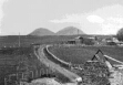
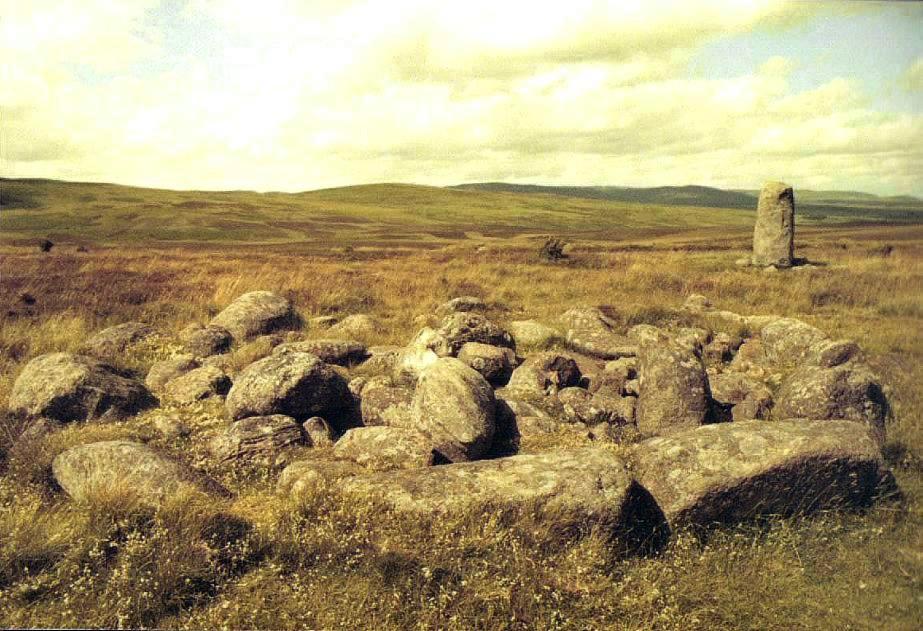
Kintraw Standing Stone & Cairn County: Argyll (Strathclyde) Ordnance Survey Grid Ref: NM 830 050 O.S. Map (Streetmap) Photo Size: 130 KB / Date: June 1990
The noted archaeo-astronomer Prof. Alexander Thom proposed that the line across the cairn, standing stone and circle were intended to mark the midwinter setting sun over the Paps of Jura, some 27 miles (43 km) distant. However, for this alignment to work the observer would need to have stood on a 'platform', identified by Thom, in a very steep gorge to the North-west of the monument, which is very difficult to access. The photo shows the monument looking North-east towards Dun an Dubh-challa. A view of the stone looking South-west towards Loch Craignish can be seen here (111 KB). |
Cairnholy I Chambered Cairn County: Wigtownshire (Dumfries & Galloway) O.S. Grid Ref: NX 518 539 O.S. Map (Streetmap) Satellite Photo (Google Maps) Photo Size: 105 KB / Date: June 1990
Excavation revealed cremated human remains, pottery and flint arrowheads. Fires had apparently been burned in the forecourt during the tomb's period of use. |
Cairnholy II Chambered Cairn County: Wigtownshire (Dumfries & Galloway) O.S. Grid Ref: NX 518 540 O.S. Map (Streetmap) Photo Size: 79 KB / Date: June 1990
|
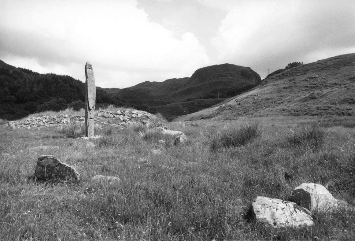
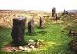
Fowlis Wester East Cairn-Circle County: Perthshire (Tayside) O.S. Grid Ref: NN 923 249 O.S. Map (Streetmap) Photo Size: 123 KB / Date: June 1990
The cairn is elliptical in plan; Alexander Thom suggested that its axis was intentionally orientated towards the most Northerly Moonrise position over distant hills. |
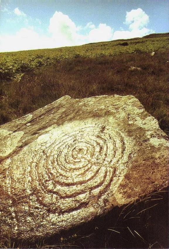
Cauldside Burn Rock Carving County: Kirkcudbrightshire (Dumfries & Galloway) O.S. Grid Ref: NX 528 574 O.S. Map (Streetmap) Photo Size: 128 KB / Date: June 1990
The stone forms an approximate alignment along ca. 160 degrees with a large cairn (107 KB) and the Cauldside Burn stone circle, some 1180 ft (360 m) away across the stream (NX 529 571). The alignment was possibly intended to indicate the winter solstice sunrise. |
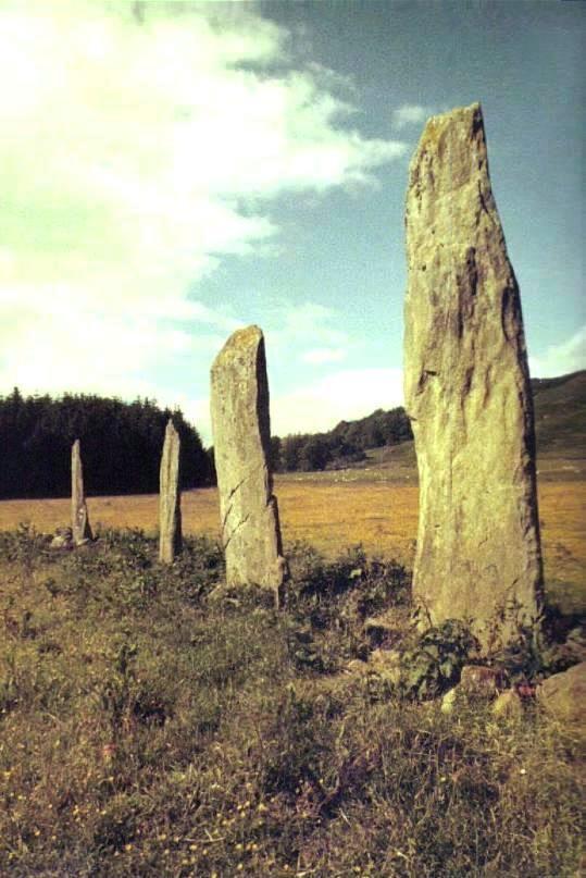
Ballymeanoch Stone Row County: Argyll (Strathclyde) O.S. Grid Ref: NR 834 964 O.S. Map (Streetmap) Photo Size: 72 KB / Date: June 1990
Alexander Thom suggested that the row was aligned towards the midwinter sunrise to the South-east, and in the opposite direction towards the most Northerly setting position of the Moon. Some 140 ft (42 m) to the South-west of the main row are a further two monoliths (143 KB), 8 ft (2.4 m) and 10 ft (3 m) tall. Thom proposed that they indicated the most Southerly rising position of the Moon towards the South-east. |
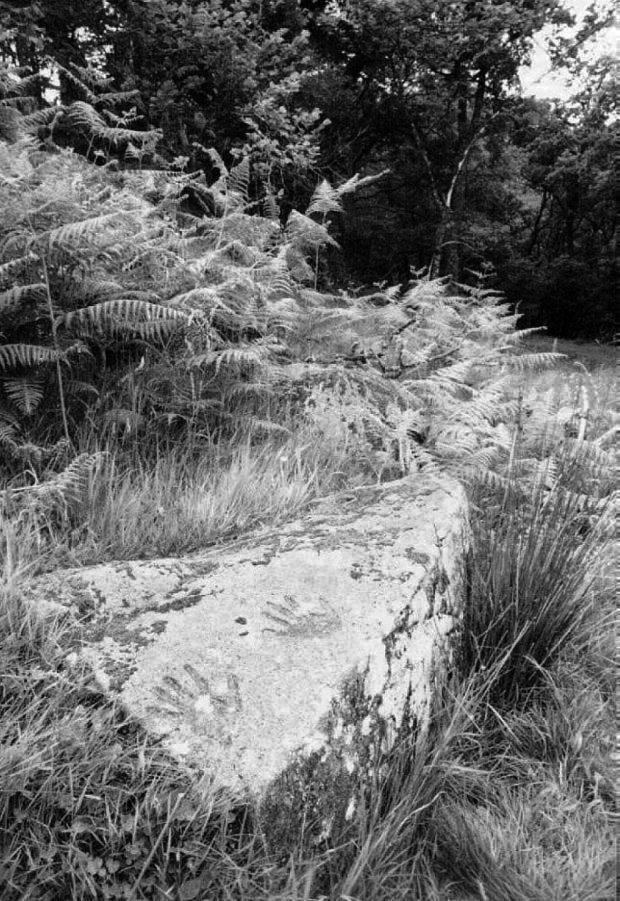
Barrnakill Hands Rock Carving County: Argyll (Strathclyde) O.S. Grid Ref: NR 822 915 O.S. Map (Streetmap) Photo Size: 143 KB / Date: June 1990
A close-up of the hands can be seen here (106 KB). |
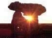
Ballochroy Stone Row & Cist County: Argyll (Strathclyde) O.S. Grid Ref: NR 730 524 O.S. Map (Streetmap) Photo Size: 43 KB / Date: June 1990
Alexander Thom believed the alignment to the South-west (96 KB) indicated the setting sun at the winter solstice. Looking along the flat face of the central slab of the alignment towards the North-west, the midsummer sun is seen to set behind the Paps of Jura, some 19 miles (30 km) distant. The photograph was taken on midsummer's eve, looking across to the Paps. |
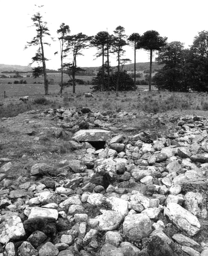
Ri Cruin Cist & Cairn County: Argyll (Strathclyde) O.S. Grid Ref: NR 825 971 O.S. Map (Streetmap) Photo Size: 116 KB / Date: June 1990
The cairn is one of several prehistoric sites which form an alignment over 1.8 miles (3 km) of the Kilmartin Valley. |
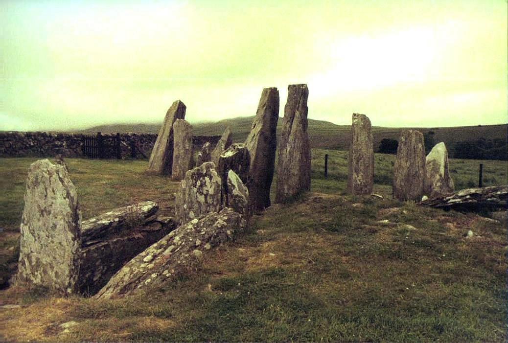
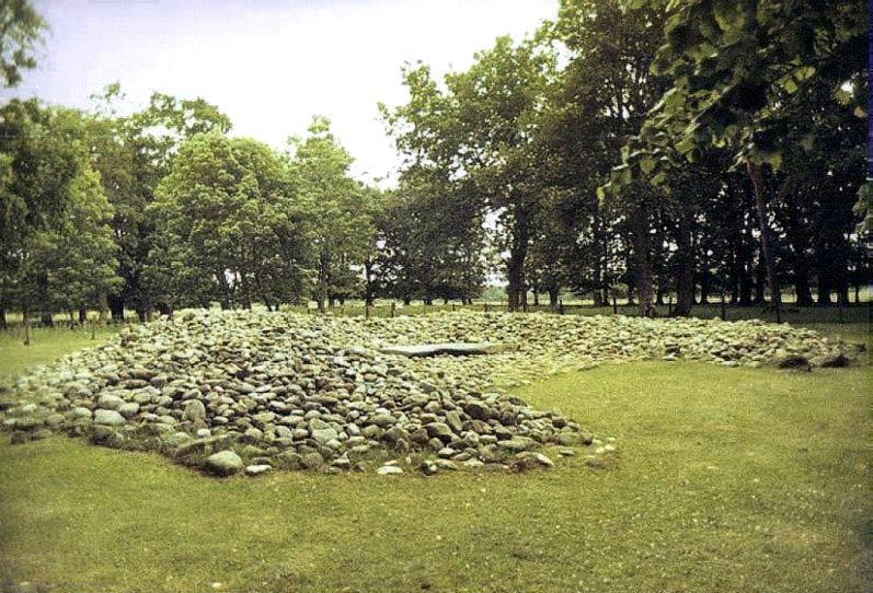
Dunchraigaig Cist & Cairn County: Argyll (Strathclyde) O.S. Grid Ref: NR 833 968 O.S. Map (Streetmap) Photo Size: 125 KB / Date: June 1990
All three chambers were found to contain burials by cremation and inhumation. |
|
Page 1 |
 Loch
Finlaggan, Islay, Scotland
Loch
Finlaggan, Islay, Scotland
 Archaeoastronomy
in South Wales
Archaeoastronomy
in South Wales
Copyright Martin J Powell 2001 - 2015


 South
Dartmoor in 3D Stereo
South
Dartmoor in 3D Stereo